
The San Andreas Fault cuts through California like a giant scar, silently shaping the Golden State’s dramatic landscapes while harboring the potential for catastrophic earthquakes. This 800-mile geological marvel represents more than just a crack in the Earth’s surface—it’s where two massive tectonic plates meet in a slow-motion dance that has fascinated scientists for generations and continues to pose significant challenges for millions of Californians.
The Geological Marvel Beneath Our Feet
What Makes the San Andreas Fault Special?
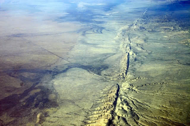
Unlike typical fault lines, the San Andreas is a transform fault where the Pacific Plate and North American Plate slide horizontally past each other. This grinding motion occurs at roughly 2 inches per year—about the same rate your fingernails grow. While this might seem insignificant, over millions of years, this movement has created California’s distinctive geography, from towering mountain ranges to fertile valleys.
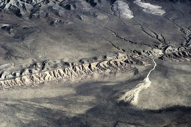
The fault isn’t a single, clean break but rather a complex network of interconnected fault zones stretching from the Salton Sea in Southern California to Cape Mendocino in the north. Its presence tells the story of Earth’s dynamic nature, providing geologists with a natural laboratory for studying plate tectonics in action.
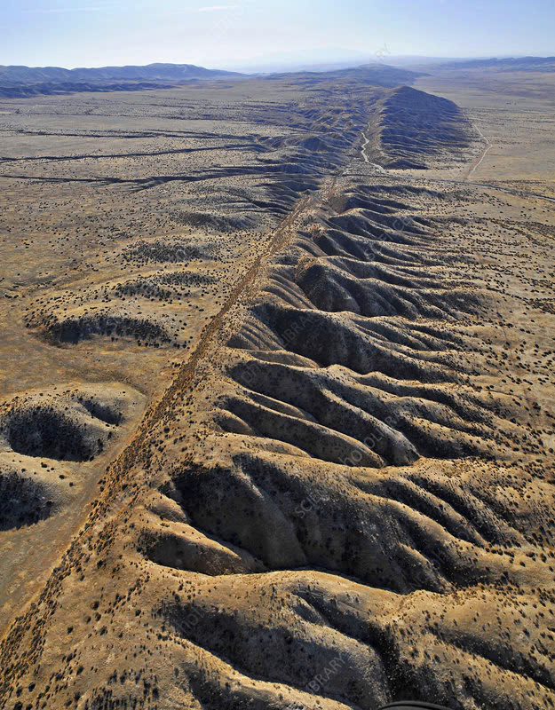
Visible Signs of an Active Earth
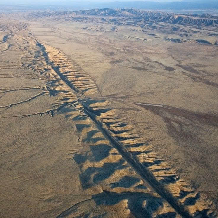
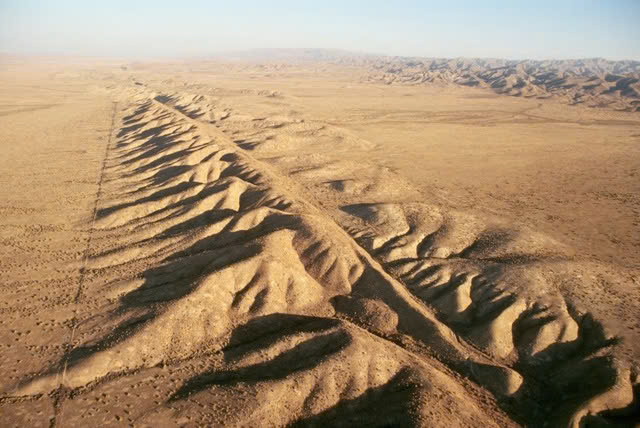
Few places showcase the fault’s presence better than the Carrizo Plain, where visitors can actually see the physical manifestation of tectonic forces at work. Here, the ground bears clear scars of past ruptures, with visible offsets in streams and ridgelines that have been displaced over centuries. The San Gabriel and Tehachapi Mountains stand as towering testaments to the immense forces at play beneath California’s surface.
When the Earth Trembles: Historical Earthquakes
The Catastrophe of 1906
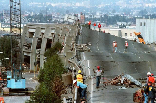
When San Francisco residents were jolted awake at 5:12 a.m. on April 18, 1906, few understood they were experiencing a pivotal moment in scientific history. The devastating 7.9 magnitude earthquake that ravaged the city wasn’t just a humanitarian disaster—it provided crucial evidence that would help scientists develop the theory of plate tectonics decades later.
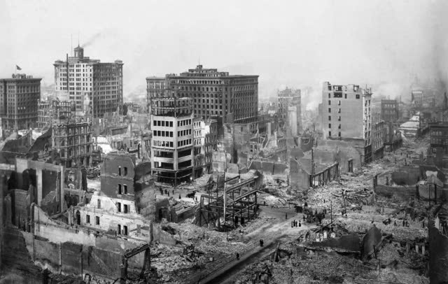
The quake ruptured 296 miles of the fault, causing the ground to shift up to 20 feet in some locations. Beyond the immediate destruction, this event fundamentally changed how we understand Earth’s structure and behavior.
Other Significant Ruptures
The 1857 Fort Tejon earthquake, with a similar 7.9 magnitude, demonstrated the fault’s destructive potential in Southern California, while the more recent 1989 Loma Prieta earthquake (6.9 magnitude) served as a stark reminder during a World Series baseball game that the fault remains active and dangerous.
The Ticking Clock: Current Status and Future Risks
The Troubling Silence in Southern California
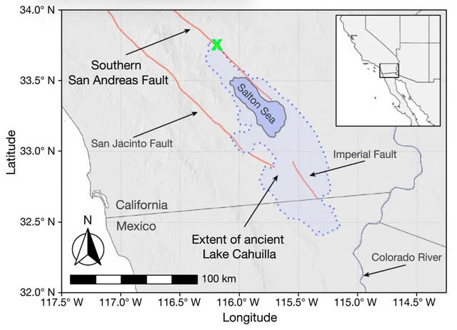
Scientists have grown increasingly concerned about the southern section of the San Andreas Fault, which has remained eerily quiet for over 300 years. Historical patterns suggest major earthquakes typically occur in this region every 180 years, indicating this section is significantly “overdue” for a major release of accumulated stress.
Research has revealed a fascinating connection between the Salton Sea’s water levels and seismic activity along this southern section. When water levels rise, they can literally bend the Earth’s crust and increase pressure within the fault system, potentially triggering earthquakes.
Video
Living with Uncertainty
California’s relationship with the San Andreas Fault resembles a high-stakes waiting game. While seismologists continue monitoring for warning signs, residents and city planners work to prepare for the inevitable. The state has implemented some of the world’s strictest building codes and invested heavily in retrofitting infrastructure to withstand major seismic events.
Public education campaigns encourage Californians to secure furniture, prepare emergency kits, and develop family evacuation plans. Meanwhile, early warning systems provide precious seconds of notice before shaking begins—potentially enough time to take cover or automatically shut down critical systems.
Coexisting with a Geological Giant
The San Andreas Fault serves as a humbling reminder of our planet’s raw power. While it poses significant risks, it has also shaped California’s breathtaking landscapes and contributed invaluably to our understanding of Earth’s processes.
As research continues and preparation technologies advance, Californians maintain their resilient spirit, acknowledging that living alongside this magnificent geological feature means accepting both its beauty and its danger. The fault’s future remains uncertain, but one thing is clear: the San Andreas will continue its slow transformation of California’s landscape for millions of years to come, one inch at a time.
